
Snow and storms forecast for South Africa as winter takes hold
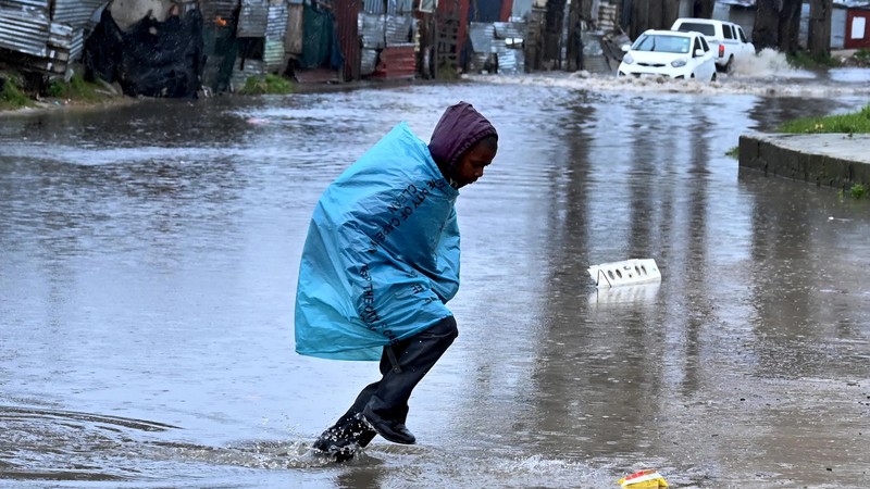

South Africans can expect a dramatic midweek weather pattern as winter flexes its full force across the central and eastern parts of the country, while sunshine prevails in the west.
According to the South African Weather Service (SAWS) forecast for Wednesday and Thursday, August 6 and 7, the nation will see a clash of cold fronts, thunderstorms, and even snowfall in parts.
Snowfall is highly likely across parts of the Eastern Cape and southern Lesotho, with a 60% chance of snow around Matatiele and surrounding mountainous regions.
Rain and cloud cover are expected to persist throughout KwaZulu-Natal, the Eastern Cape interior, and parts of Mpumalanga, with a 30 to 60% chance of rain in areas like Mthatha and Newcastle.
Wind speeds along the coastal regions will vary from 20 to 50 km/h, while interior winds remain breezy and cold. Despite the chill, the Western Cape will enjoy clearer skies.
Towns like Cape Town and Vredendal are in for fine to partly cloudy conditions with crisp, dry air and temperatures expected to remain cold but stable.
By Thursday, the snow risk eases, but the weather remains unsettled in the central and eastern regions.
Thunderstorms are likely across central South Africa, particularly around Johannesburg, Klerksdorp, and Welkom, where a 60% chance of rain is expected.
Rain will continue across KwaZulu-Natal with a 30% probability along the coast, including Durban, Port Shepstone and Mthatha.
The Western Cape remains largely shielded from the turmoil. Sunny and dry conditions are forecast in Vredendal and surrounding areas, although cold morning temperatures will persist.
With volatile weather gripping much of the interior and east, residents are urged to prepare for slippery roads, possible travel delays, and the need for extra winter layers.
IOL